

5 Minute Read
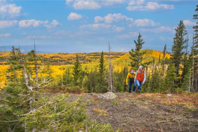
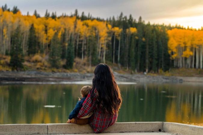
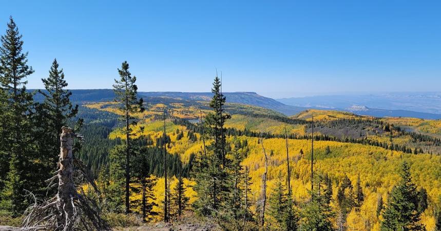
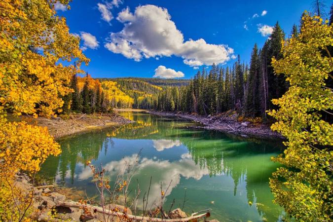
The largest flat-top mountain in the world, the Grand Mesa, offers cool temperatures and striking mountain scenery reflected elegantly in the calm waters of the alpine lakes. Standing at 11,000 feet above sea level, the Grand Mesa National Forest is chock-full of hundreds of hiking trails – most of which connect to one of the 300 lakes that nourish this mesa. Ranging from short and easy to long and challenging, the Grand Mesa has a hike for every skill level and a stunning view around every corner.
Lost Lake Hike on Grand Mesa (moderate hike)
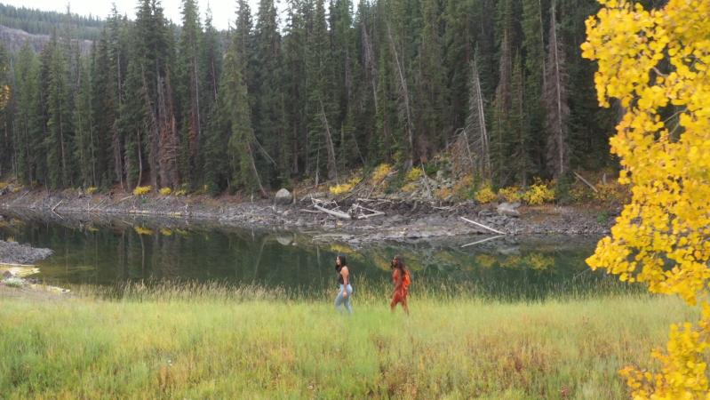
At roughly 3.5 miles round-trip, the Lost Lake hike takes you deep into the pines before opening up not once but twice to reveal two pristine alpine lakes. While the trail climbs several hundred feet, there are many scenic vistas where hikers can stop and take a break, so plan to share this experience with the kiddos or come with friends. The pine trees provide shade and the trail is well maintained. Other than a few slight inclines, the trail is mostly flat. Looking for a bonus hike? The Lost Lake hike leads to two separate picturesque alpine lakes - South Mesa Lake and Lost Lake. Both lakes have crystal clear water which makes it interesting and exciting to watch the trout that occupy these waters. Access to the Lost Lake Trail can be found at the Glacier Springs Trailhead in Grand Mesa National Forest. Once you reach Lost Lake, kick back, have a snack, and enjoy the lake’s strikingly clear water.
Ward Lake Loop (easy hike)
Ward Lake Loop is a 1.8-mile hike that uses a connector trail and a dirt road to create an easy loop around Ward Lake. This hike follows the shoreline most of the way, so it isn’t a very rocky hike and offers numerous fishing spots, as well as intermittent shade. In late summer, pass by alpine wildflowers that bloom in lush meadows. Along the way, there are multiple bathroom facilities. Parking is at Ward Way Picnic Area and the trailhead is easily accessible.
Lake of the Woods Trail (moderate hike)
Just 45 miles east of Grand Junction, the Lake of the Woods Trail on the Grand Mesa includes the added perk of a stunning drive on a National Scenic and Historic Byway, Colorado Highway 65. The hike is primarily flat, meandering through shady forests and meadows that burst with color during wildflower season in late summer. What makes it challenging is its length - 8 miles, requiring about 4.5 hours to complete the entire loop. It crosses several streams, including Bull Creek, which offers easy access to excellent fishing pools along its upper mile, as well as multiple lakes and reservoirs paying homage to its namesake, Lake of the Woods. The multi-use trail is open to hiking, horseback riding and mountain biking.
The “Combo Meal” Lake Hike: Grand Mesa’s Crag Crest Trail (strenuous hike)
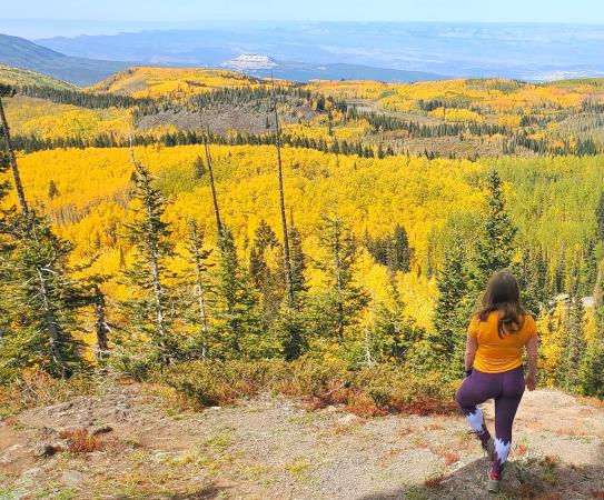
As the most renowned of the hikes on the Grand Mesa and voted the number one Grand Mesa hike by AllTrails, the Crag Crest National Recreation Trail offers stunning views of hundreds of Grand Mesa lakes, as well as up-close visits to others. However, you most likely won’t have much time for lakeside leisure because this trail is about twelve miles long (out and back), with steep climbs and rocky descents. Hiking the Crag Crest Trail is not a casual (or quick) endeavor and is not for the faint of heart. The hike takes about 7 hours to complete, but hikers that take on this challenge are met with diversely beautiful terrain. From thick pine forests and dramatic rock cliffs to luscious meadows and sprawling horizons glittering with sparkling lakes. At the highest points of the trail – including the section along the “spine” of the Grand Mesa with drop-offs on either side - you’ll have a 360° view for hundreds of miles, which makes it all worth it. Of course, you can always turn back before you get to the end, just to ease the pressure a bit.
Things to Know About Hiking on Grand Mesa
- Grand Mesa offers great dog-friendly hikes with plenty of shade making for comfortable temperatures and easy access to drinking water for your four-legged hiking buddies. Unless posted specifically, dogs can hike off-leash provided they are always under voice control and won’t harass wildlife or other trail users. Please be aware of dog leash laws and always pack out what you pack in (dog waste included).
- Don’t go empty-handed. Even on a short hike, it’s important to carry a few things to ensure a comfortable and enjoyable day. Be sure to take sunscreen, water, and snacks. Don’t be fooled into thinking you don’t need sunscreen by the cooler temperatures on Grand Mesa or an overcast day. The higher elevation means you’ll get a sunburn faster, even if you don’t feel hot.
- Mosquito repellant (summer hiking)! Enough said.
- Snow can sometimes last on the Grand Mesa trails into mid-June, and snowstorms can start as early as September. Even in the height of summer, storms can move in bringing sleet, rain or hail. Be sure to check weather conditions before going out on a long hike and take layers of clothing, extra snacks and water, in the case of an emergency.
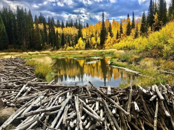
Why Are There So Many Lake Hikes on Grand Mesa?
If you’re looking to escape the Grand Junction summer heat and experience some gorgeous lakeside views, the Grand Mesa averages about one lake for every 1.6 square miles. So, why are there so many lakes on the Grand Mesa?
Grand Mesa owes its wealth of lake hikes, in part, to its high elevation. Higher elevations offer cooler temperatures because there is less surface evaporation and more precipitation. Grand Mesa National Forest receives more rain and snow compared to nearby Grand Junction – making it on average about 20 degrees cooler. Furthermore, geologic history tells us that ancient glaciers covered 10% of the state, including much of Grand Mesa. The receding glaciers left moraines, huge mounds of rock and cavities that filled with melting ice and snowmelt.
The 300 alpine lakes of the Grand Mesa are well worth the drive from Grand Junction for a hike (short or long), an afternoon of picnicking and fishing, or some postcard-worthy vacation photos!
Plan your lake hike using seasonal tips for hiking on the Grand Mesa found on page 12-13 of the Official Grand Junction Visitor Guide.