

Photo by: Esther Shapiro
5 Minute Read
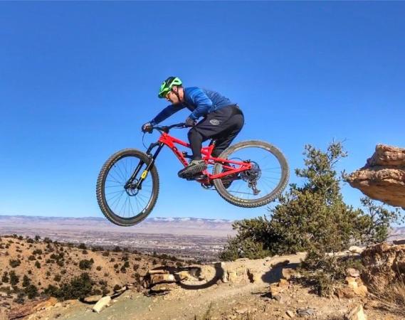
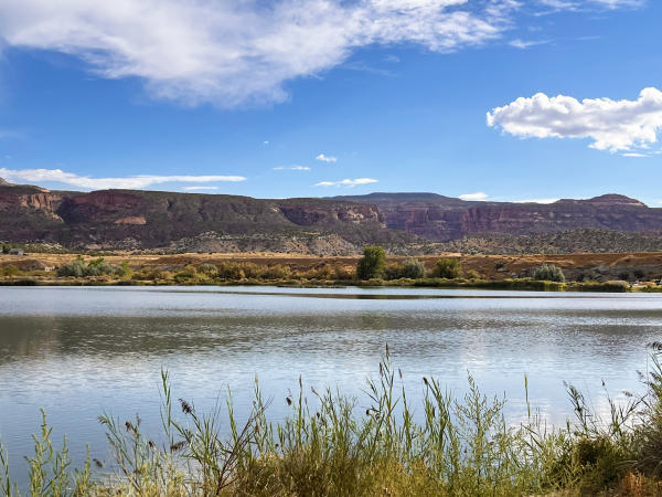
Grand Junction is a perfect outdoor playground for recreation enthusiasts, surrounded by over 1.5 million acres of public land, towering red rock canyons, winding rivers, and wide-open landscapes. Additionally, one can enjoy a calm float on a paddleboard down the Colorado River as it snakes through town. For those seeking a two-wheel thrill, kick up gravel on a mountain bike or enjoy a relaxing ride along the paved Colorado Riverfront Trail. Most of the bike areas are accessible year-round, close to town, and there are numerous friendly bike shops that offer rentals and free advice. Hiking opportunities surround Grand Junction in every direction. Less than 10 minutes from Downtown, Colorado National Monument offers more than 43 miles of trails weaving through towering red rock canyons and spectacular desert terrain.
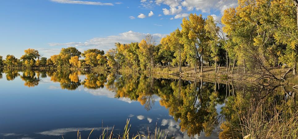
Photo by: Ray Mathis
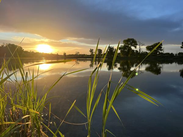
One of the best ways to experience Grand Junction is on a bike along the Colorado Riverfront Trail. The 28-mile paved trail winds beside the Colorado River, through wetlands and shady cottonwood groves, and past parks and scenic overlooks along the way. The Riverfront Trail is convenient if you prefer not to venture too far from town, and it is broken up into different sections – all of which provide unique experiences and views of the Grand Junction area.
Riverbend Park
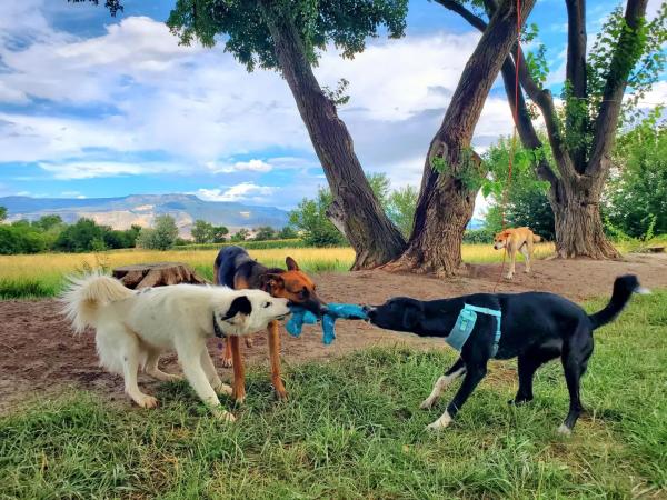
At 3.7 miles in length, the Riverbend Park section of the Colorado Riverfront Trail is the easternmost part and is surrounded by a host of activities. Sandwiched between the Colorado River and Riverbend Park, this portion is one of the few places to take your pup off-leash and let them roam about the park. While Fido runs around the large grassy area and along the river, you can relax on the many shaded benches and take in sweeping views of the surrounding mesas. It’s also very wheelchair accessible with a dock overlooking the river.
Clifton Nature Area
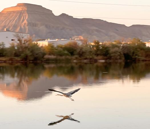
Continuing west from Riverbend Park is the Clifton Nature Area. Although not connected to the Riverbend Park portion, this section stretches from 33 ½ Road in Clifton to Corn Lake - James M. Robb Colorado River State Park and the state wildlife area before eventually ending at 29 Road. This peaceful stretch rolls past tranquil wetlands and ponds, where riders often spot birds gliding overhead and wildlife gathering along the water’s edge. Most of the six-mile trail borders state land, so there are no roads and only a few driveways to cross. It is common to see wildlife as critters that may be quenching their thirst at the water’s edge. There are also some great nesting areas for large birds of prey, so don’t forget to look up.
Riverside, Las Colonias & Eagle Rim
Although there is not a designated trail from 29 Road heading west, there is an underpass near the Colorado River that cyclists use. Ride on the bike lane or sidewalk to reach the underpass to cross 29 Road safely, and then continue the route on the west side of 29 Road along C ½ Road to Las Colonias Park. C ½ Road is a low-trafficked road and connects right to the park. There are several parking areas and bathrooms at Las Colonias, so it’s a great place to start or end a bike ride. It’s also a city park, so no entrance fee is required (see below for additional park fee information).
If you want to get close to the river at Las Colonias, cross over the bridge near the Western Colorado Botanical Gardens and ride the short, paved loops on Watson Island. There are plenty of great spots to pose for photos right next to the river. The island is home to a popular disc golf course, so be courteous of other park users and keep an eye out for flying discs. If you find a disc (frisbee) while playing and bring it to Triple Play Records in Downtown Grand Junction, they will help return it to the owner if there’s a name or phone number on it. As a thank-you for turning it in, they typically give the finder a small reward such as store credit or a free used CD or record from the shop’s bins. It’s part of the local disc-golf culture in Grand Junction—encouraging people to return lost discs rather than keep them. The store has long served as an informal lost-and-found hub for discs in the area. It’s a cool shop and worth the stop.
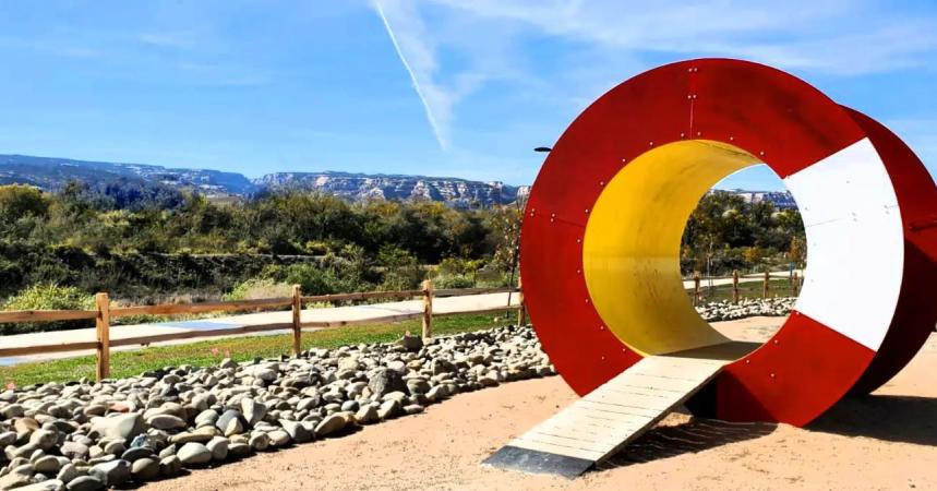
Photo by: @mateoisms
The Riverfront Trail continues west with an underpass at 5th Street before going through Dos Rios. The bike park and playground at Dos Rios add an energetic stop along the trail, where kids play while riders take a break beside the river. The path continues through the Riverside Park area, where there is another playground and picnic shelter with plenty of shade. Follow the route under Highway 340 toward Connected Lakes.
Audubon, Blue Heron & Connected Lakes
From the underpass, riders have the option of taking an out-and-back spur that goes to the popular Lunch Loops mountain bike area or continuing west on the Riverfront Trail. Those who want to head toward Lunch Loops can cross the 340 bridge on the west sidewalk and then signs direct riders to the paved route that crosses back under the road and meanders for a bit through a neighborhood before continuing next to Monument Road. It’s a great way to get to Lunch Loops without riding on or crossing the road.
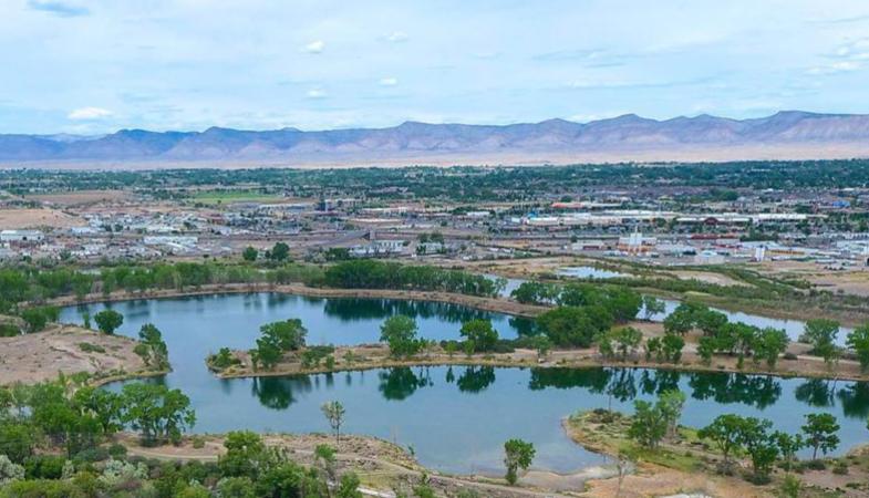
At Connected Lakes - James M. Robb Colorado River State Park, cyclists also have the option to do a scenic loop in the park by heading south at the river, riding on the sidewalk across the Redlands Parkway bridge, and then remaining on the sidewalk for almost a mile to South Rim Drive. It’s a pretty steep hill up to South Rim and the park, but it’s a fun loop through Connected Lakes. Signs direct riders to turn and head into the park and down the winding trail. There are often pedestrians and a few blind turns, so controlled speed and cautious riding are important here.
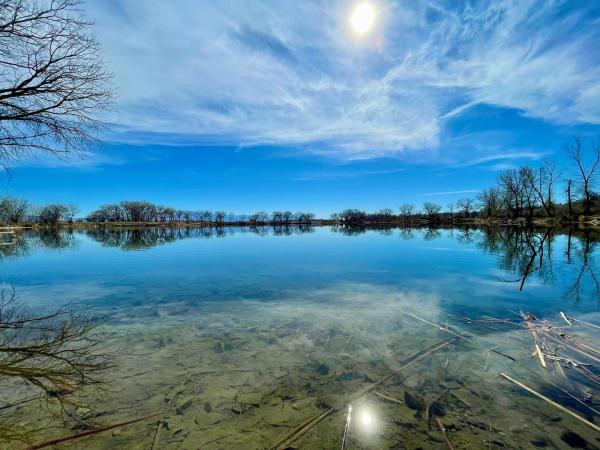
This part of the trail winds through the trees, so it is cool and shady, making it a great spring, summer and fall trail. Continue through the entire park as it goes almost back to Highway 340. Ride across the 340 bridge on the west sidewalk, then hop back on the Riverfront Trail. The loop over the river and through Connected Lakes is about seven to ten miles, depending on the starting point. Continue west to the Blue Heron area - this section is close to the river, and there is a popular boat launch if you’re looking to get on or off the river.
Monument View
The final stretch is the Monument View section, which leads west to Fruita. It is one of the newest portions and although this stretch is rather straight and long, it offers unexpected stunning views of the Colorado National Monument that stands tall in the distance to the south of the trail. Stay safe and use your peripheral vision as the trail crosses driveways and roads.
Know Before You Go
The Riverfront Trail winds through two areas of the James M. Robb Colorado River State Park at Corn Lake and Connected Lakes. Although both parks have parking and other amenities, those who access the trail from the state park must pay an entrance fee. If riding through the park and not stopping to have a picnic or use park facilities, then no fee is required.
Photo: Nicholas Vezakis
One Riverfront is a non-profit organization that partners with various community groups to foster stewardship and enhance the Colorado and the Gunnison River corridors. For additional information about the Riverfront Trail, including maps with parking lots and mileage of the various sections, reference this link. For more ways to experience Grand Junction, check out the Official Grand Junction Visitor Guide.